

NC’s Most Charming Mountain Road Trip Route: The Mayland Meander
Ready to explore a quieter side of the North Carolina High Country? The new Mayland Meander map guides travelers through 12 charming mountain towns across Mitchell, Avery, and Yancey counties. Image: Todd Bush

Think you know the North Carolina Mountains? Think again. Grab the new Mayland Meander Road Map and discover the hidden gems throughout the High Country. The illustrated guide highlights places to eat, shop, stay, and explore in 12 charming small towns across Mitchell, Avery, and Yancey counties. Time to pack and hit the road!
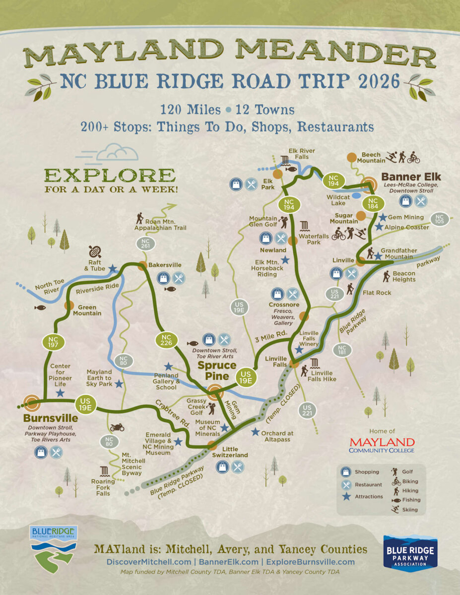
The Mayland Meander marks the first time Mitchell, Avery, and Yancey counties have joined forces to showcase the hidden gems that await travelers willing to venture beyond the High Country’s best-known destinations.
“I always felt that, because we represent smaller areas, we needed to combine forces and do something together to raise awareness of what the places and people we represent offer tourists,” says Kelly Jones, Tourism Development Authority Director for Mitchell County.

Embracing the philosophy of strength in numbers, the TDA offices from Mitchell, Avery, and Yancey counties worked together to create the Mayland Meander Map. Though the project was well underway before Hurricane Helene hit Western North Carolina in late September 2024, it has since become more important as sections of the Blue Ridge Parkway are still under reconstruction due to the damage Helene caused.
Launched in mid-March of this year, the map provides easy instructions for how to access the charming towns and activities in this part of the region using highways and local roads.
A Road Map to Hidden Mountain Gems
With so many amenities and attractions to explore in the tri-county area, choosing which destinations and points of interest to highlight was a challenge, Kelly admits.
“We knew we couldn’t fit everyone, so we tried to keep the focus on outdoor recreation. We know when you’re getting from one outdoor recreation point to the other, then you’re still going to go through the towns and have the opportunity to experience the sights and sounds of each,” she explains.
Asked which of the places and activities included in the map she would list as can’t-miss opportunities, Kelly emphasizes the chance to visit the towns because “Your exploration grows just by having conversations with the locals.”

She continues, “I think if you go into the heartbeats of these counties and explore the towns and the small businesses, that’s where you can even learn a greater sense of who we are and what we’ve been through and why this map is so important to us so that we don’t get left out.”
That’s the whole purpose of the map — to encourage local visitors and those from further away to “meander” through and see for themselves what makes these counties so special.
TDA Director for Yancey County, Sue Wasserman, agrees that the Blue Ridge Parkway shutdowns in the area were affecting the usual bustling traffic coming and going from Burnsville, the county hub. It’s also the largest and only incorporated town in Yancey.
“Suddenly, this big piece of traffic that we had from people going to the parkway was being challenged,” Sue says. The Maylander Map offered alternatives, making travel to these areas possible while highlighting a wide variety of points of interest to appeal to everyone.
The Mayland Meander highlights destinations including Banner Elk, Crossnore, Little Switzerland, and Bakersville, home to the renowned Penland School of Craft and Penland Gallery and Visitors Center, along with eight other charming mountain towns waiting to be discovered.
Sue sees this exposure as a wonderful chance to encourage visitors and locals to explore and appreciate all the area has to offer. As she puts it, “Every opportunity to share with people how amazing this region is is a good opportunity.”
Can’t-Miss Stops Along the Way
Burnsville and the surrounding towns on the Mayland Meander Map are a huge artist community. The area is rich in history, and tourists can experience it by booking a room at the NuWray Hotel, the oldest continually operating hotel in the state.

Burnsville is also home to the Parkway Playhouse, the oldest continually operating summer theater in North Carolina, and Toe River Arts, which hosts a twice-annual studio tour. “I made sure we added the Center for Pioneer Life to the map because it’s a really unique place just off US Route 19 and focuses on Appalachian life,” Sue says. “There are some old cabins, and it is a great place to gain an appreciation of the history of the area.”
Among Sue’s can’t-miss recommendations is Mayland Earth to Sky Park, home to a planetarium, observatory, and one of only two certified dark sky parks of its kind in the world. The other is in South Korea.
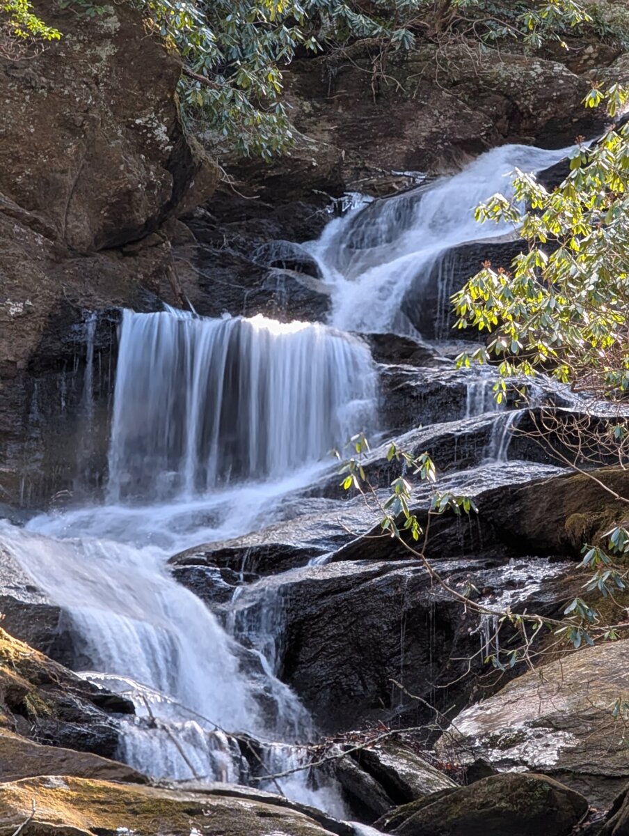
For those who want to take advantage of the region’s beautiful year-round natural scenery, she suggests visiting Roaring Fork Creek Falls (off NC Highway 80 and just below the parkway). It is a family-friendly destination, and a short, easy half-mile walk will take you to the falls.
With something for everyone, the 2026 Mayland Meander Map invites you to embark on an incredible journey and create travel memories that will last a lifetime.
**********
Looking for more travel inspiration? Visit our archives HERE.

Melinda Burris
I’m a passionate writer who enjoys sharing interesting people, places, and happenings with readers. A native North Carolinian, I love to travel and collect art of all types from folk and fine oil paintings to pottery.